
Pend Oreille River Elevation and Flow.
New and improved river flow information for the Pend Oreille River will provide more accurate and timely information.
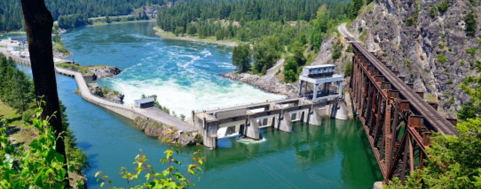
To view the river flows, click on the photos below or use the following links for Newport & Cusick. To view the National Water Dashboard, click here: USGS


River Flow at Box Canyon Dam is calculated by taking the highest recorded flow from the previous eight hours. Actual flows may be different.
As adopted by the County and the Federal Emergency Management Agency (FEMA), the flood level on the section of river between Newport and Box Canyon begins when the river is flowing at 95,000 CFS. When the flow is at 95,000 CFS, the elevation at Cusick is approximately 2,042.0 feet.
For more information, please contact the Pend Oreille County Department of Emergency Management:
- Pend Oreille County Public Information Line: 509-447-1988
- Pend Oreille County Department of Emergency Management: 509-447-3731
During the flood year of 1997, the peak elevation at Cusick, WA was 2049.9 feet. See more information on the Flood Forecast webpage.
Box Canyon Dam is a run of the river project. The Corps of Engineers operates Albeni Falls, the upstream project, to accommodate flood control, power generation, environmental, biological, and other requirements. The PUD has limited control over river flows, elevations, and flow control.
Additional information available:
National Weather Service Northwest River Forecast Center
U.S. Army Corps of Engineers, CENWD-WM System Map
For information on Watershed or Eurasian Water Milfoil, visit the TriState Water Quality Council site.
Check the Drought Watch site for information on the water resources in this area.
Albeni Falls Dam Outflow
For updated information go to:
The National Weather Service. Click on the “Rivers and Lakes” tab above the map, select the green (or yellow) box under Albeni Falls Dam and it will take you to the information on the outflow at Albeni Falls Dam.
National Weather Service
Residents and business owners should continue to rely on the National Weather Service for flood watches and warnings.
No Wake Speed Limit
Please call (509) 447-1988 for the current ‘No Wake’ Status!
The “No Wake Speed Limit” is made as required in the Pend Oreille County Boating Safety Ordinance No. 2001-01. Specifically the ordinance states, “Whenever the elevation, at the Cusick gauging station, is at or exceeds 2,041 feet there shall be in affect a ‘No Wake Speed Limit.’”
The ordinance defines wake speed: “Means a slow speed producing no wake and further does not exceed five miles per hour.”
Violations of the “No Wake Speed Limit” could cost you a fine of $66.
The Pend Oreille County Department of Emergency Management is monitoring the river level on a daily basis. Current information can be obtained by calling 509-447-1988. The recording is updated daily.